AERIAL INTELLIGENCE / EARTHWORK VOLUMES

AERIAL INTELLIGENCE / EARTHWORK VOLUMES

AERIAL INTELLIGENCE / EARTHWORK VOLUMES

Know what moved.
Plan what comes next.

Know what moved.
Plan what comes next.

Know what moved.
Plan what comes next.

Turn an active earthwork site into measurable terrain. Aerial LiDAR and mapping help you understand stockpiles, compare surfaces, and put the next phase of work in perspective.

Turn an active earthwork site into measurable terrain. Aerial LiDAR and mapping help you understand stockpiles, compare surfaces, and put the next phase of work in perspective.

Turn an active earthwork site into measurable terrain. Aerial LiDAR and mapping help you understand stockpiles, compare surfaces, and put the next phase of work in perspective.

Explore the data

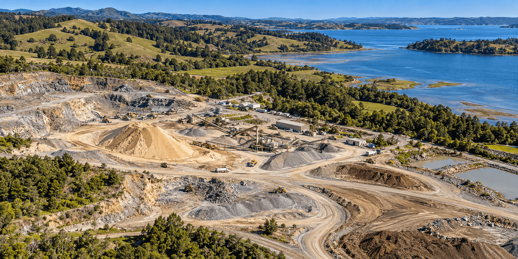
Wide realistic aerial illustration of a coastal aggregate site with stockpiles, terraced earthwork, wooded hills, and an estuary
AERIAL LiDAR / EARTHWORK VOLUMESLiDAR / VOLUME MODEL
MEASURE THE MATERIALMaterial volumes.
Measured from above.
Surface models · Stockpile volumes
01 / DATA OUTPUTStockpile volume

Material surface compared with its base.

02 / DATA OUTPUTGround elevation

Bare-earth levels for cut-and-fill planning.

ILLUSTRATIVE SCENES / SIMULATED SCANS
01 / DATA OUTPUTStockpile volume

Material surface compared with its base.

02 / DATA OUTPUTGround elevation

Bare-earth levels for cut-and-fill planning.

Aerial intelligence. Precision data for land and water.

EARTHWORK VOLUMES

EARTHWORK VOLUMES

THE QUANTITY BEHIND THE DECISION

THE QUANTITY BEHIND THE DECISION

THE QUANTITY BEHIND THE DECISION

Make the site measurable.

Make the site measurable.

Make the site measurable.

How much material is on site? Where has the ground changed? What remains between current conditions and the planned surface? We build the dataset around the question, connecting terrain and volume calculations to the boundaries, reference surfaces, and dates that make them useful. Your team gets a shared view of the work, with the context needed to interpret the numbers.

How much material is on site? Where has the ground changed? What remains between current conditions and the planned surface? We build the dataset around the question, connecting terrain and volume calculations to the boundaries, reference surfaces, and dates that make them useful. Your team gets a shared view of the work, with the context needed to interpret the numbers.

How much material is on site? Where has the ground changed? What remains between current conditions and the planned surface? We build the dataset around the question, connecting terrain and volume calculations to the boundaries, reference surfaces, and dates that make them useful. Your team gets a shared view of the work, with the context needed to interpret the numbers.

WHERE THE DATA MAKES A DIFFERENCE

WHERE THE DATA MAKES A DIFFERENCE

WHERE THE DATA MAKES A DIFFERENCE

From material inventory to the next move.

From material inventory to the next move.

From material inventory to the next move.

Stockpile inventory

Stockpile inventory

Stockpile inventory

Measure individual piles or grouped material areas against an agreed base surface. Use volume estimates to support inventory planning, material movement, and conversations between field and office teams.

Measure individual piles or grouped material areas against an agreed base surface. Use volume estimates to support inventory planning, material movement, and conversations between field and office teams.

Measure individual piles or grouped material areas against an agreed base surface. Use volume estimates to support inventory planning, material movement, and conversations between field and office teams.

Cut-and-fill planning

Cut-and-fill planning

Cut-and-fill planning

Compare existing ground with a supplied design or reference surface. See where material needs to be removed or placed, and use the resulting quantities to inform earthwork planning.

Compare existing ground with a supplied design or reference surface. See where material needs to be removed or placed, and use the resulting quantities to inform earthwork planning.

Compare existing ground with a supplied design or reference surface. See where material needs to be removed or placed, and use the resulting quantities to inform earthwork planning.

Progress over time

Progress over time

Progress over time

Compare captures from different stages of a project to locate surface changes and estimate material movement. Establish a consistent record for progress reviews and decisions about the next phase.

Compare captures from different stages of a project to locate surface changes and estimate material movement. Establish a consistent record for progress reviews and decisions about the next phase.

Compare captures from different stages of a project to locate surface changes and estimate material movement. Establish a consistent record for progress reviews and decisions about the next phase.

FROM CAPTURE TO INTELLIGENCE

FROM CAPTURE TO INTELLIGENCE

FROM CAPTURE TO INTELLIGENCE

See the data in action.

See the data in action.

See the data in action.

Explore a simulated aerial capture. Move between the scene, classified points, and the measurements they support.

Explore a simulated aerial capture. Move between the scene, classified points, and the measurements they support.

Explore a simulated aerial capture. Move between the scene, classified points, and the measurements they support.

Earthwork INTERACTIVE EXAMPLE
AERIAL LiDAR / STOCKPILE VOLUMESSynthetic model · Scan paused
Drag to orbit · Click to inspect
LOWHIGH

Synthetic scenes and simulated measurements demonstrate potential mapping outputs. Project deliverables, reference systems, and accuracy requirements are defined for each scope.

DELIVERABLES WITH A PURPOSE

DELIVERABLES WITH A PURPOSE

DELIVERABLES WITH A PURPOSE

Data your team can work with.

Data your team can work with.

Data your team can work with.

01

01

01

Classified point cloud

Classified point cloud

Classified point cloud

A spatial record of the captured site, with classification defined around the project. Inspect ground and above-ground features, and retain the underlying detail behind derived surfaces.

A spatial record of the captured site, with classification defined around the project. Inspect ground and above-ground features, and retain the underlying detail behind derived surfaces.

A spatial record of the captured site, with classification defined around the project. Inspect ground and above-ground features, and retain the underlying detail behind derived surfaces.

02

02

02

Terrain models and contours

Terrain models and contours

Terrain models and contours

An elevation surface and contour mapping that describe the shape of the site. Agree the coverage, reference system, and level of detail around the decisions the model needs to support.

An elevation surface and contour mapping that describe the shape of the site. Agree the coverage, reference system, and level of detail around the decisions the model needs to support.

An elevation surface and contour mapping that describe the shape of the site. Agree the coverage, reference system, and level of detail around the decisions the model needs to support.

03

03

03

Volume analysis

Volume analysis

Volume analysis

Stockpile or cut-and-fill quantities calculated within defined boundaries and against an agreed reference surface. Keep those assumptions alongside the results so each number has a clear basis.

Stockpile or cut-and-fill quantities calculated within defined boundaries and against an agreed reference surface. Keep those assumptions alongside the results so each number has a clear basis.

Stockpile or cut-and-fill quantities calculated within defined boundaries and against an agreed reference surface. Keep those assumptions alongside the results so each number has a clear basis.

04

04

04

Surface comparisons

Surface comparisons

Surface comparisons

Maps and summaries showing elevation differences between captures or between existing and proposed conditions. Identify where change is concentrated and connect it to the wider site plan.

Maps and summaries showing elevation differences between captures or between existing and proposed conditions. Identify where change is concentrated and connect it to the wider site plan.

Maps and summaries showing elevation differences between captures or between existing and proposed conditions. Identify where change is concentrated and connect it to the wider site plan.

THE QUESTION SHAPES THE DATA

THE QUESTION SHAPES THE DATA

THE QUESTION SHAPES THE DATA

Define the measurement before the flight.

Define the measurement before the flight.

Define the measurement before the flight.

01 /

01 /

01 /

Define the quantity.

Define the quantity.

Define the quantity.

Identify the piles, work areas, or surfaces to compare. Share the decision, timeframe, available plans, and any previous data so the measurement has a clear starting point.

Identify the piles, work areas, or surfaces to compare. Share the decision, timeframe, available plans, and any previous data so the measurement has a clear starting point.

Identify the piles, work areas, or surfaces to compare. Share the decision, timeframe, available plans, and any previous data so the measurement has a clear starting point.

02 /

02 /

02 /

Agree the reference.

Agree the reference.

Agree the reference.

Set the coordinate system, vertical reference, base surface, and comparison boundaries. Review site access, visibility, and any control or independent checks the project needs before collection.

Set the coordinate system, vertical reference, base surface, and comparison boundaries. Review site access, visibility, and any control or independent checks the project needs before collection.

Set the coordinate system, vertical reference, base surface, and comparison boundaries. Review site access, visibility, and any control or independent checks the project needs before collection.

03 /

03 /

03 /

Plan the handoff.

Plan the handoff.

Plan the handoff.

Choose the outputs, file formats, and comparison dates around how your team works. Document relevant assumptions and limitations alongside the surfaces and quantities you will use.

Choose the outputs, file formats, and comparison dates around how your team works. Document relevant assumptions and limitations alongside the surfaces and quantities you will use.

Choose the outputs, file formats, and comparison dates around how your team works. Document relevant assumptions and limitations alongside the surfaces and quantities you will use.

BEFORE WE GET STARTED

BEFORE WE GET STARTED

BEFORE WE GET STARTED

Questions before we scope.

Questions before we scope.

Questions before we scope.

Can you compare the site with our design surface?

Can you compare the site with our design surface?

Can you compare the site with our design surface?

Yes, that comparison can be scoped around a supplied design surface. We first review its coverage, coordinate system, vertical reference, and suitability for the intended calculation.

Yes, that comparison can be scoped around a supplied design surface. We first review its coverage, coordinate system, vertical reference, and suitability for the intended calculation.

Yes, that comparison can be scoped around a supplied design surface. We first review its coverage, coordinate system, vertical reference, and suitability for the intended calculation.

What affects a volume result?

What affects a volume result?

What affects a volume result?

The captured surface, pile boundaries, base surface, reference system, and site visibility all matter. We define those inputs during scoping so the result can be understood in context.

The captured surface, pile boundaries, base surface, reference system, and site visibility all matter. We define those inputs during scoping so the result can be understood in context.

The captured surface, pile boundaries, base surface, reference system, and site visibility all matter. We define those inputs during scoping so the result can be understood in context.

Do volume measurements tell us material weight?

Do volume measurements tell us material weight?

Do volume measurements tell us material weight?

Volume and weight are different measurements. Converting a volume to weight requires an appropriate material density and consideration of its condition; that information must be established for the project.

Volume and weight are different measurements. Converting a volume to weight requires an appropriate material density and consideration of its condition; that information must be established for the project.

Volume and weight are different measurements. Converting a volume to weight requires an appropriate material density and consideration of its condition; that information must be established for the project.

YOUR NEXT PROJECT STARTS HERE

YOUR NEXT PROJECT STARTS HERE

YOUR NEXT PROJECT STARTS HERE

What needs measuring?

What needs measuring?

What needs measuring?

Share the site, the material or work area, and the decision ahead. We’ll help scope the aerial data and volume analysis your project needs.

Share the site, the material or work area, and the decision ahead. We’ll help scope the aerial data and volume analysis your project needs.

Share the site, the material or work area, and the decision ahead. We’ll help scope the aerial data and volume analysis your project needs.

MORE WAYS TO UNDERSTAND YOUR SITE

MORE WAYS TO UNDERSTAND YOUR SITE

MORE WAYS TO UNDERSTAND YOUR SITE