AERIAL INTELLIGENCE / CONSERVATION

AERIAL INTELLIGENCE / CONSERVATION

AERIAL INTELLIGENCE / CONSERVATION

Measure the landscape.
Track what changes.

Measure the landscape.
Track what changes.

Measure the landscape.
Track what changes.

Aerial LiDAR and mapping give conservation teams a measurable baseline of terrain, vegetation structure, and shoreline position. Build evidence for restoration planning, focus fieldwork, and compare site conditions over time.

Aerial LiDAR and mapping give conservation teams a measurable baseline of terrain, vegetation structure, and shoreline position. Build evidence for restoration planning, focus fieldwork, and compare site conditions over time.

Aerial LiDAR and mapping give conservation teams a measurable baseline of terrain, vegetation structure, and shoreline position. Build evidence for restoration planning, focus fieldwork, and compare site conditions over time.

Explore the data

Wide realistic aerial illustration of a coastal estuary, woodland canopy, salt marsh shorelines, tidal channels, and a boardwalk
AERIAL LiDAR / HABITAT MAPPINGLiDAR / CANOPY + GROUND
ESTABLISH THE BASELINEHabitat baselines.
Change over time.
Canopy structure · Wetland boundaries
01 / DATA OUTPUTCanopy structure

Vegetation height relative to the ground.

02 / DATA OUTPUTShoreline position

A mapped habitat edge for change comparisons.

ILLUSTRATIVE SCENES / SIMULATED SCANS
01 / DATA OUTPUTCanopy structure

Vegetation height relative to the ground.

02 / DATA OUTPUTShoreline position

A mapped habitat edge for change comparisons.

Aerial intelligence. Precision data for land and water.

CONSERVATION

CONSERVATION

START WITH THE QUESTION

START WITH THE QUESTION

START WITH THE QUESTION

A baseline your next decision can build on.

A baseline your next decision can build on.

A baseline your next decision can build on.

Where is the ground changing? How does vegetation structure vary across the site? Has the shoreline moved? We help turn those questions into a defined collection area and useful spatial data. The result is a shared reference for project teams, field specialists, and the people responsible for monitoring progress.

Where is the ground changing? How does vegetation structure vary across the site? Has the shoreline moved? We help turn those questions into a defined collection area and useful spatial data. The result is a shared reference for project teams, field specialists, and the people responsible for monitoring progress.

Where is the ground changing? How does vegetation structure vary across the site? Has the shoreline moved? We help turn those questions into a defined collection area and useful spatial data. The result is a shared reference for project teams, field specialists, and the people responsible for monitoring progress.

WHERE THE DATA HELPS

WHERE THE DATA HELPS

WHERE THE DATA HELPS

Connect site conditions to conservation priorities.

Connect site conditions to conservation priorities.

Connect site conditions to conservation priorities.

Restoration planning

Restoration planning

Restoration planning

Understand existing elevations, slopes, drainage context, and disturbed ground before work begins. Use the baseline to help compare restoration options, locate areas for closer investigation, and document how the physical site develops through construction and recovery.

Understand existing elevations, slopes, drainage context, and disturbed ground before work begins. Use the baseline to help compare restoration options, locate areas for closer investigation, and document how the physical site develops through construction and recovery.

Understand existing elevations, slopes, drainage context, and disturbed ground before work begins. Use the baseline to help compare restoration options, locate areas for closer investigation, and document how the physical site develops through construction and recovery.

Vegetation structure

Vegetation structure

Vegetation structure

Map canopy height and the spatial pattern of vegetation relative to the ground. Identify structural differences across a large area, focus field visits, and compare repeat collections to assess where vegetation has grown, been removed, or changed in distribution.

Map canopy height and the spatial pattern of vegetation relative to the ground. Identify structural differences across a large area, focus field visits, and compare repeat collections to assess where vegetation has grown, been removed, or changed in distribution.

Map canopy height and the spatial pattern of vegetation relative to the ground. Identify structural differences across a large area, focus field visits, and compare repeat collections to assess where vegetation has grown, been removed, or changed in distribution.

Shoreline and wetland monitoring

Shoreline and wetland monitoring

Shoreline and wetland monitoring

Record shoreline positions, terrain, and selected site features across coastal or wetland environments. Repeat mapping can help locate movement and erosion patterns. Collection timing and water levels provide context for interpreting differences between collection dates.

Record shoreline positions, terrain, and selected site features across coastal or wetland environments. Repeat mapping can help locate movement and erosion patterns. Collection timing and water levels provide context for interpreting differences between collection dates.

Record shoreline positions, terrain, and selected site features across coastal or wetland environments. Repeat mapping can help locate movement and erosion patterns. Collection timing and water levels provide context for interpreting differences between collection dates.

FROM CAPTURE TO INTELLIGENCE

FROM CAPTURE TO INTELLIGENCE

FROM CAPTURE TO INTELLIGENCE

See the data in action.

See the data in action.

See the data in action.

Explore a simulated aerial capture. Move between the scene, classified points, and the measurements they support.

Explore a simulated aerial capture. Move between the scene, classified points, and the measurements they support.

Explore a simulated aerial capture. Move between the scene, classified points, and the measurements they support.

Conservation INTERACTIVE EXAMPLE
AERIAL LiDAR / TERRAIN & VEGETATIONSynthetic model · Scan paused
Drag to orbit · Click to inspect
LOWHIGH

Synthetic scenes and simulated measurements demonstrate potential mapping outputs. Project deliverables, reference systems, and accuracy requirements are defined for each scope.

DATA YOUR TEAM CAN USE

DATA YOUR TEAM CAN USE

DATA YOUR TEAM CAN USE

From collected returns to a working baseline.

From collected returns to a working baseline.

From collected returns to a working baseline.

01

01

01

Terrain models and contours

Terrain models and contours

Terrain models and contours

Ground-surface elevations and contours for examining slopes, low areas, and drainage context, with coverage and reference information documented for your project.

Ground-surface elevations and contours for examining slopes, low areas, and drainage context, with coverage and reference information documented for your project.

Ground-surface elevations and contours for examining slopes, low areas, and drainage context, with coverage and reference information documented for your project.

02

02

02

Vegetation structure layers

Vegetation structure layers

Vegetation structure layers

Canopy-height and structural information derived from LiDAR returns, helping your team examine vegetation patterns alongside terrain and field observations.

Canopy-height and structural information derived from LiDAR returns, helping your team examine vegetation patterns alongside terrain and field observations.

Canopy-height and structural information derived from LiDAR returns, helping your team examine vegetation patterns alongside terrain and field observations.

03

03

03

Mapped shoreline positions

Mapped shoreline positions

Mapped shoreline positions

A dated spatial record of the shoreline and agreed site features, providing a reference for future comparison and project coordination.

A dated spatial record of the shoreline and agreed site features, providing a reference for future comparison and project coordination.

A dated spatial record of the shoreline and agreed site features, providing a reference for future comparison and project coordination.

04

04

04

Change comparisons

Change comparisons

Change comparisons

Comparisons between compatible datasets that highlight differences in elevation, vegetation structure, or mapped feature position, with collection conditions considered.

Comparisons between compatible datasets that highlight differences in elevation, vegetation structure, or mapped feature position, with collection conditions considered.

Comparisons between compatible datasets that highlight differences in elevation, vegetation structure, or mapped feature position, with collection conditions considered.

SCOPED AROUND YOUR SITE

SCOPED AROUND YOUR SITE

SCOPED AROUND YOUR SITE

Plan the baseline. Make comparisons useful.

Plan the baseline. Make comparisons useful.

Plan the baseline. Make comparisons useful.

01 /

01 /

01 /

Define the monitoring question

Define the monitoring question

Define the monitoring question

Agree on the site boundary, intended decisions, existing data, and features that need measurement. Establish what the baseline must capture and how your team will use it.

Agree on the site boundary, intended decisions, existing data, and features that need measurement. Establish what the baseline must capture and how your team will use it.

Agree on the site boundary, intended decisions, existing data, and features that need measurement. Establish what the baseline must capture and how your team will use it.

02 /

02 /

02 /

Plan comparable collection

Plan comparable collection

Plan comparable collection

Consider access, vegetation season, water conditions, reference systems, and the timing of repeat captures so the collection approach supports meaningful comparisons.

Consider access, vegetation season, water conditions, reference systems, and the timing of repeat captures so the collection approach supports meaningful comparisons.

Consider access, vegetation season, water conditions, reference systems, and the timing of repeat captures so the collection approach supports meaningful comparisons.

03 /

03 /

03 /

Choose useful outputs

Choose useful outputs

Choose useful outputs

Select the models, mapped features, file formats, and comparisons that fit your workflow. Define deliverables before collection so the data serves a clear purpose.

Select the models, mapped features, file formats, and comparisons that fit your workflow. Define deliverables before collection so the data serves a clear purpose.

Select the models, mapped features, file formats, and comparisons that fit your workflow. Define deliverables before collection so the data serves a clear purpose.

COMMON QUESTIONS

COMMON QUESTIONS

COMMON QUESTIONS

Know what the data can answer.

Know what the data can answer.

Know what the data can answer.

Can aerial data replace ecological field assessments?

Can aerial data replace ecological field assessments?

Can aerial data replace ecological field assessments?

Aerial mapping measures physical structure and spatial change. Field observations provide context about species, habitat condition, and ecological processes. Combining both helps teams interpret what the mapped differences mean.

Aerial mapping measures physical structure and spatial change. Field observations provide context about species, habitat condition, and ecological processes. Combining both helps teams interpret what the mapped differences mean.

Aerial mapping measures physical structure and spatial change. Field observations provide context about species, habitat condition, and ecological processes. Combining both helps teams interpret what the mapped differences mean.

Can we compare new data with an existing dataset?

Can we compare new data with an existing dataset?

Can we compare new data with an existing dataset?

We start by reviewing its coverage, date, reference system, resolution, and available quality information. That establishes which comparisons are useful and where differences in collection conditions could affect interpretation.

We start by reviewing its coverage, date, reference system, resolution, and available quality information. That establishes which comparisons are useful and where differences in collection conditions could affect interpretation.

We start by reviewing its coverage, date, reference system, resolution, and available quality information. That establishes which comparisons are useful and where differences in collection conditions could affect interpretation.

Can a project include both land and water?

Can a project include both land and water?

Can a project include both land and water?

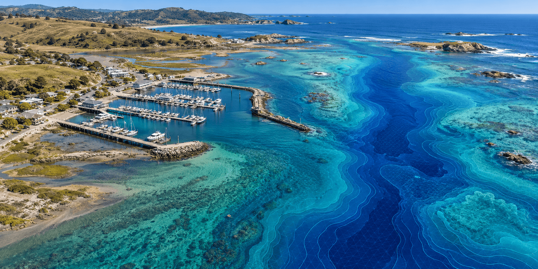
Yes. Aerial and bathymetric mapping can be scoped together to connect terrain, shoreline, and underwater conditions. Each uses the collection method appropriate to the environment and the project question.

Yes. Aerial and bathymetric mapping can be scoped together to connect terrain, shoreline, and underwater conditions. Each uses the collection method appropriate to the environment and the project question.

Yes. Aerial and bathymetric mapping can be scoped together to connect terrain, shoreline, and underwater conditions. Each uses the collection method appropriate to the environment and the project question.

BUILD YOUR NEXT BASELINE

BUILD YOUR NEXT BASELINE

BUILD YOUR NEXT BASELINE

What change do you need to understand?

What change do you need to understand?

What change do you need to understand?

Tell us about the site, the decision ahead, and any existing datasets. We’ll help define the data needed to move your conservation project forward.

Tell us about the site, the decision ahead, and any existing datasets. We’ll help define the data needed to move your conservation project forward.

Tell us about the site, the decision ahead, and any existing datasets. We’ll help define the data needed to move your conservation project forward.

MORE WAYS TO UNDERSTAND YOUR SITE

MORE WAYS TO UNDERSTAND YOUR SITE

MORE WAYS TO UNDERSTAND YOUR SITE