A NEW PERSPECTIVE ON YOUR PROJECT

A NEW PERSPECTIVE ON YOUR PROJECT

A NEW PERSPECTIVE ON YOUR PROJECT

A clearer picture.
Above and below.

A clearer picture.
Above and below.

A clearer picture.
Above and below.

From the ground you move to the waters you navigate. LiDAR and bathymetric intelligence that brings your next decision into focus.

From the ground you move to the waters you navigate. LiDAR and bathymetric intelligence that brings your next decision into focus.

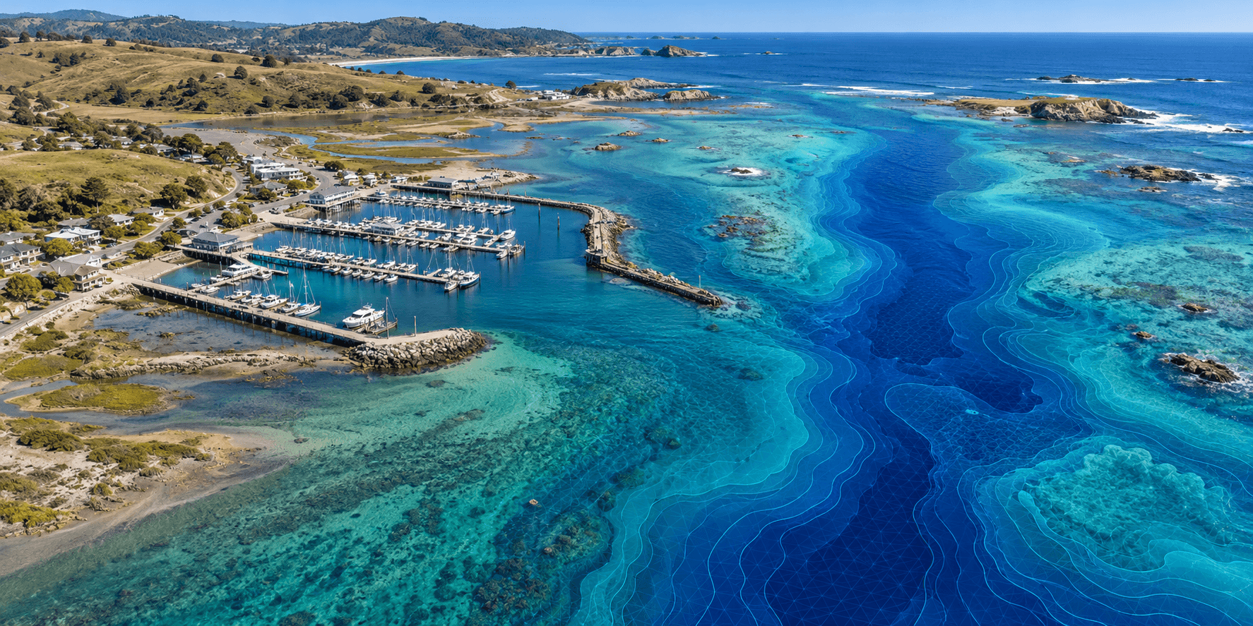
Realistic illustrative aerial view of a coastal marina, clear turquoise water, and bathymetric seafloor contours
BATHYMETRY / COASTAL INTELLIGENCESONAR / DEPTH PROFILE
REVEAL THE DEPTHThe picture beneath
the surface.
Seafloor contours · Channel definition
01 / SURVEY OUTPUTDepth model

Soundings referenced to a survey datum.

02 / SURVEY OUTPUTSeafloor contours

Channel shape and shallow areas.

ILLUSTRATIVE SCENES / SIMULATED SCANS
01 / SURVEY OUTPUTDepth model

Soundings referenced to a survey datum.

02 / SURVEY OUTPUTSeafloor contours

Channel shape and shallow areas.

Understand the terrain. Reveal the depth. Move forward with context.

Understand the terrain. Reveal the depth. Move forward with context.

EXPLORE APPLICATIONS

EXPLORE APPLICATIONS

EXPLORE APPLICATIONS

01 / WHERE INSIGHT MEETS IMPACT

01 / WHERE INSIGHT MEETS IMPACT

01 / WHERE INSIGHT MEETS IMPACT

Different environments.
The same need for clarity.

Different environments.
The same need for clarity.

Different environments.
The same need for clarity.

Start with the decision you need to make.
We’ll help define the data that gets you there.

Start with the decision you need to make.
We’ll help define the data that gets you there.

01 — LAND

Know where you stand.

Know where you stand.

Know where you stand.

Turn complex terrain into a clearer plan for your site.

Turn complex terrain into a clearer plan for your site.

Earthwork & volumes

Earthwork & volumes

Understand stockpiles, compare surfaces, and inform cut-and-fill planning.

Floodplain & drainage context

Floodplain & drainage context

Reveal terrain, flow paths, and low-lying areas to support assessment.

Conservation & restoration

Conservation & restoration

Establish a baseline and track changes in habitat, terrain, and shorelines.

Discuss a land project

02 — WATER

See beneath the surface.

See beneath the surface.

See beneath the surface.

Bring underwater conditions into your operational picture.

Bring underwater conditions into your operational picture.

Marinas & vessel access

Marinas & vessel access

Document depths for larger-vessel access planning and operational risk reviews.

Channels & dredging

Channels & dredging

Identify shoaling, inform channel marking, and help scope dredging work.

Coastal monitoring

Coastal monitoring

Compare the seabed and shoreline over time to understand change.

Discuss a water project

02 / A LITTLE EXPLORATION. A LOT OF PERSPECTIVE.

02 / A LITTLE EXPLORATION. A LOT OF PERSPECTIVE.

02 / A LITTLE EXPLORATION. A LOT OF PERSPECTIVE.

There’s more to the surface.

There’s more to the surface.

There’s more to the surface.

Explore four ways spatial data can help answer
the questions behind your next move.

Explore four ways spatial data can help answer
the questions behind your next move.

INTERACTIVE CONCEPT
LiDAR / SURFACE MODELSynthetic model · Scan paused
Drag to orbit · Click to inspect
LOWHIGH

These animated models use synthetic terrain and illustrative measurements. Explore natural surfaces, scan passes, classified returns, and separated layers. Actual project measurements use validated survey data.

03 / BUILT AROUND YOUR NEXT DECISION

03 / BUILT AROUND YOUR NEXT DECISION

03 / BUILT AROUND YOUR NEXT DECISION

From a complex site
to a clear next step.

From a complex site
to a clear next step.

A good map starts with a good question. We work with you to connect the right collection approach to something your team can actually use.

A good map starts with a good question. We work with you to connect the right collection approach to something your team can actually use.

SCOPED TO YOUR PROJECT

Surface models · Contours · Depth maps
Volume analysis · Change comparisons

01

Tell us what’s at stake.

Tell us what’s at stake.

Tell us what’s at stake.

Your site, your timeline, and the decision you need to make. We start there.

02

Define the right picture.

Define the right picture.

Define the right picture.

Align the survey area, collection method, reference system, and deliverables with your project.

03

Put the data to work.

Put the data to work.

Put the data to work.

Bring findings into planning, project coordination, and ongoing monitoring.

LET’S PUT YOUR PROJECT ON THE MAP

LET’S PUT YOUR PROJECT ON THE MAP

What do you
need to see
more clearly?

What do you
need to see
more clearly?

What do you
need to see
more clearly?

Tell us a little about your site and what you’re trying to solve. Start a conversation about what geospatial intelligence could make possible.

Tell us a little about your site and what you’re trying to solve. Start a conversation about what geospatial intelligence could make possible.

Land. Water. The space between.
Let’s find your next perspective.

Start with your project.

A few details are all it takes.

Preview mode: this form does not send or store information. You can review and download a local inquiry draft.

YOUR PROJECT, IN FOCUS

Your inquiry draft.

Review your details below. Nothing has been sent.

Blue Streak

BLUE STREAK

GEOSPATIAL

A clearer picture. Above and below.

BLUE STREAK GEOSPATIAL

BLUE STREAK GEOSPATIAL

BLUE STREAK GEOSPATIAL